
We hereby welcome you to the PECSRL 2026, the 31st session of the Permanent European Conference for the Study of the Rural Landscapes (PECSRL, see www.pecsrl.org). This biannual congress gathers landscape researchers across Europe and beyond who study mainly rural landscapes of the past, present, and future from an interdisciplinary perspective, including historical geography, landscape ecologists, social scientists, human geographers, physical geographers, historians, archaeologists, rural planners, landscape architects, landscape managers, as well as other scholars and practitioners interested in European landscapes.
PECSRL 2026 will be organized in Ghent and Spa (Belgium) as a collaboration of Ghent University and the University of Liège.
The registrations for the conference are open! More details about the registration process can be found here.
Conference theme
Landscapes embody the continuous dialogue between people and land through time. They can be read as palimpsests of the interaction between biophysical and environmental processes and societies adapting and reshaping their surroundings. Once primarily shaped by agrarian livelihoods and relatively stable demographic patterns, rural landscapes are now navigating complex challenges, including climate change impacts, environmental degradation, biodiversity loss, land-use conflicts, social inequality, shifting cultural identities… Main driving forces, such as demography, economy, politics, technology, and natural calamities, initiate a series of interacting landscape change processes.
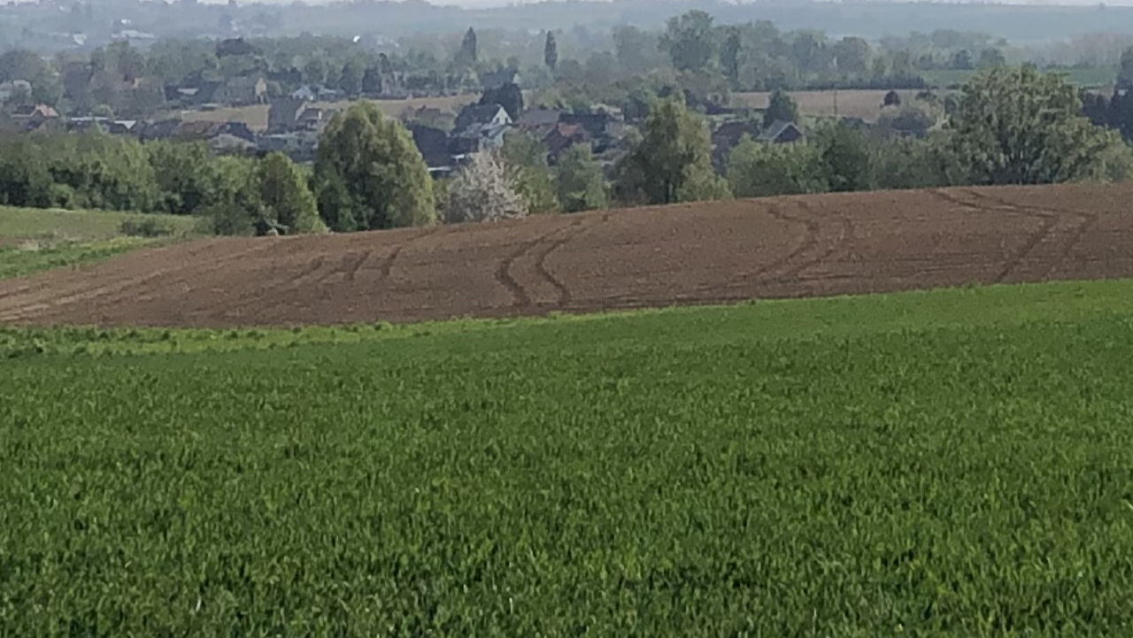
The landscapes we live in today – our living landscapes – are shaped by complex feedback loops, often leading to a polarisation of geographical space. Densely populated areas are characterised by processes of urbanisation, intensification, industrialisation, and competition between land uses, while depopulation has led to ruralisation, land and settlement abandonment, the loss of the agricultural mosaic, and the decline of services. As more people live in urban places than in rural areas and the rural population is declining, the relationship between urban and rural areas has changed over time.
In this context, there is an urgent need to seek balance and foster harmony among the often conflicting, competing, and even contradictory demands or interests placed on the whole range of rural landscapes currently facing similar challenges, such as climate change impacts, environmental degradation, social inequality, … Landscapes with high and low human pressures have different resilience and adaptability when it comes to responses to flooding and drought, biodiversity loss, food security, heritage protection, landscape management,...
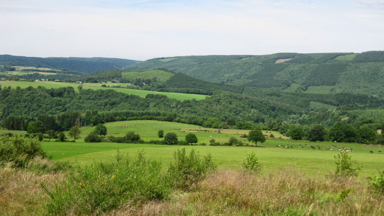
The challenge is how to study these over- and depopulated landscapes from a structural, functional, and historical perspective. How to understand the intertwining factors that play a role in and shape landscapes? How to strengthen urban-rural connections? How to regenerate empty landscapes, reduce regional disparities, and support landscape community resilience?
The conference theme will focus on how to understand the process of finding balance or harmony among conflicting, opposing, contradictory demands or interests in landscapes.
PECSRL 2026 will discuss the following processes that are at stake in a variety of European landscapes and resulting in different stages of change and continuity in both rural and urbanised landscapes.
- Intensification and extensification
- Multifunctionality and homogenisation
- Urbanisation and ruralisation
- Overpopulated and empty landscapes
- Abandonment and revitalisation
- Flooding and drought
- Development and restoration
- Disconnecting and linking
- Coupling and segregation
Programme
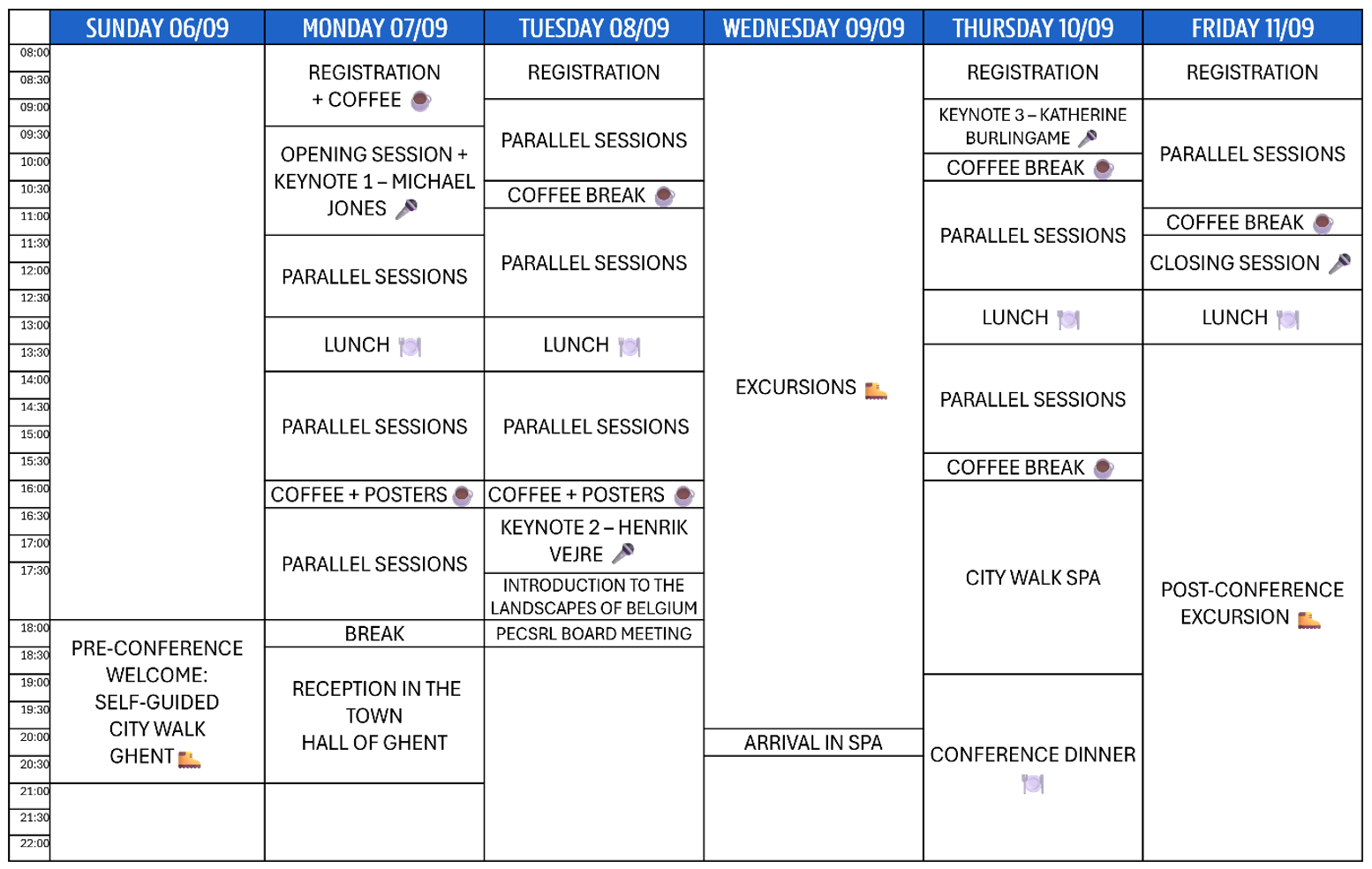
- During the first two days (7 and 8 September) in Ghent, the opening session, keynotes, parallel and poster sessions will be scheduled.
- The field trips are planned on Wednesday (9 September), allowing the participants an experience of traveling across a range of Belgian landscapes.
- The two days (10 and 11 September) in Spa will host the keynotes and parallel sessions, the conference dinner, and the closing session.
- Following the conference, a post-conference excursion will be organised (11 to 13 September).
The detailed program and schedule of the sessions can be found here.
Plenary sessions
The conference includes four plenary sessions:
Monday
- Plenary session: welcoming words and the introduction to the conference theme.
- Keynote 1: Michael Jones, Professor Emeritus from the Department of Geography at the Norwegian University of Science and Technology (https://www.ntnu.edu/employees/michael.jones)
Tuesday
- Keynote 2: Henrik Vejre, Professor at the Department of Geosciences and Natural Resource Management at the University of Copenhagen (https://researchprofiles.ku.dk/en/persons/henrik-vejre/)
- Plenary lecture: Introduction to the landscape of Belgium
Thursday
- Keynote 3: Katherine Burlingame, postdoctoral fellow at the Department of Archaeology, Conservation and History of the University of Oslo (https://www.hf.uio.no/iakh/english/people/aca/archaeology/temporary/katherbu/)
Friday
- Closing session: What do we take home and to the next PECSRL?
Session overview
The sessions organised by the participants will contribute to the interaction, discussions, and experiences during PECSRL2026. A total of 18 sessions, spread across 33 session blocks, will explore a wide range of topics, tackling different challenges in a variety of landscapes. The session overview can be found below the program.
Call for abstracts
The call for abstracts has been closed. A detailed overview of all abstracts will be published in the end of August.
Field trips
On Wednesday, 9 September, the participants will join one of the excursions that will bring them from Ghent to Spa. The descriptions give the main theme and outline the general itinerary, with initial suggestions for potential stops. Field trips 1 to 4 will be organised by the colleagues of the Department of Geography of Ghent, field trip 5 by the colleagues of the University of Liège. All field trips will leave early morning in Ghent and arrive in Spa between 18:00 and 20:00, and are organised as a bus trip with short walks on different stops.
After you register for the conference, you will receive a follow-up email where you can indicate your preferred field trip.
Field trip 1 – From forests in the urban shadow of Brussels over open-field rural landscapes of the Brabant Massif to the industrial valley of the river Sambre
Even though the southeastern region of Brussels is characterised by intensive urbanisation, it still contains vast forested and rural landscapes located on the rich loamy soils of the Brabant Massif.
This field trip explores the Sonian Forest, a remnant of about 5000 ha of the vast Silva
Carbonaria (Charcoal Forest) that stretched from the North Sea to the Rhine River.
In the Middle Ages, the Dukes of Brabant maintained it as a private hunting ground.
In the 18th century, it was transformed into a "beech cathedral" forest. Today,
it is managed by three regions of the federal state of Belgium, is part of one of the
Flemish National Parks, and serves as a unique ‘green lung’ - combining biodiversity and heritage -
at only 10 km from the centre of the European Capital. The village of Hoeilaart developed in a
clearing of this forest and became a residential suburb.
Next, we cross the Brabant loess-plateau, with its vast open-field agricultural landscape, and
take a quick look at the battlefield of Waterloo (1815), where Napoleon I's defeat changed
the map of Europe entirely. More to the south, rivers eroded deep and disclosed the geologic
base of the Brabant Massif. Here we visit the ruins of the Abbey of Villers-la-Ville, a former
Cistercian abbey and one of Wallonia's outstanding heritage sites. Further south, we cross the
Sambre-et-Meuse industrial valley and enjoy a panoramic view over the industrial conurbation
of Charleroi. Before continuing to Spa, we follow the Sambre valley to Namur, the capital
of the Walloon Region, to study the site of the city.
Field trip 2 – The Black Country: from rural to derelict industrial and urban landscapes in 200 years
Since the early 19th century, the landscapes along the rivers Haine, Samber and Meuse have been intensively transformed by coal mining. Historical agricultural landscapes rapidly changed into an industrial region, with associated urbanisation typologies and infrastructures. Now the region has a rich industrial past, specific landscapes, working-class neighbourhoods, and a profound socio-economic transformation following the closure of the mines.
This field trip discovers the first impact of the Industrial Revolution on the European continent in the early 19th century. The Borinage and the Centre, situated between Mons and La Louvière (Walloon region, province of Hainaut), were the cradle of the fourth-largest coal-mining-based industrial development in the world. From the 1820s on, the rural landscapes have been wiped away entirely, and this area has changed drastically due to the Industrial Revolution, driven by coal mining development and the production of coal and steel. In a short period, the agricultural landscape transformed into a dense industrial area. New industrial sites, sophisticated and adapted transportation infrastructure (railways and canals), and newly designed towns and urban development were built. The misery and hard life of the coal miners were depicted by Vincent Van Gogh, who worked as a pastor in the community. In the 1960s, coal mines were closed, and the associated industry and transportation infrastructure became obsolete and derelict. The region is still struggling to regain a sustainable economic and ecological reconversion. We visit some of the ‘Major Mining Sites of Wallonia’ that were listed as UNESCO World Heritage in 2012, and we will walk along the old canals with hydraulic ship elevators and look for the area's reconversions and revitalisation.
Field trip 3 – Landscapes harvesting tasty products: crossing the open fields and fruit belt of Hesbaye to the chalk land along the Meuse valley
The landscapes of Hesbaye, one of Belgium’s main productive agricultural regions, extend across loamy plateaus, creating fertile conditions for diverse crops. Often divided into two subregions based on the geological substrate, creating a gradient from the northern “humid” Hesbaye to the southern “dry” Hesbaye, the first agricultural activities date back to the Neolithic period, and its landscapes still produce a diversity of products.
When arriving in Hasbeye, this field trip will first visit the open-field landscapes in the southern part around Hoegaarden and Tienen. The focus on arable farming and the production of grain and sugar beets made towns more important. Due to Hoegaarden's enclave status, it was an excellent location for beer production in the 18th century, and it is now internationally known. A short stop in Vechmaal will illustrate the nuances of landscape characteristics in relation to the biophysical context and provide an example of a local marl quarry. When driving northwards, the fruit belt producing apples, pears and cherries characterises the landscapes. In Borgloon, the capital of the Count of Loon until the 14th century and now the cradle of the fruit syrup production, we will visit the renovated historic syrup factory that tells the history of this local food production. A walk through the orchards will pass by some examples of land art in the agrarian landscape. The importance of the Roman period for the region is evident in Tongeren, one of Belgium's main Roman cities, where several relics are still visible in the centre. Since the end of the 20th century, vineyards have been established on the gentle slopes where the loamy soils contain marl and chalk. The castle of Genoels-Elderen is one example of a site where viticulture dates back to Roman times. Before arriving in Spa, the field trip will pass the chalk land along the Meuse valley and cross the river Jeker.
Field trip 4 – Crossing agricultural open-field landscapes and historical villages along the linguistic border in Hesbaye
Exploring the landscapes of Hesbaye (Haspengouw in Dutch) goes together with crossing multiple boundaries. The historical territories in the Middle Ages were fragmented. The Flemish-French linguistic border was quite diffuse and shifted over time, becoming sharper only for political reasons in the 1960s. The fertile, loamy plateaus lead to open-field landscapes and numerous historical villages.
This field trip will cross the linguistic and historical borders of the southern part of Hesbaye and illustrate how these boundaries affect landscape development over time. For example, the territorial structure and fragmentation of the Prince-Bishopric of Liège, the Duchy of Brabant, and the County of Loon resulted in different relationships among settlements. We will visit the historic village of Meldert, dating back to the 13th century and home to two generations of castles. The agricultural open-field landscapes around Hoegaarden will be explored in detail, focusing on the historical development of this traditional landscape and the current challenges in agriculture, land consolidation, and nature protection. The journey will continue to Sint-Gitter (in the municipality of Landen), founded in the 7th century and the cradle of the Carolingian dynasty, which ruled the Frankish Empire. When driving further eastwards, the basic model of the historical villages in the open-field landscapes can be studied in Limont. After passing Tongeren, the excursion will end in Alden Biesen, one of the former Land Commanderies of the Teutonic Order. Founded in the 13th century, it became the centre of power and religious influence until the French Revolution. The site is now managed as a heritage site of the Flemish Region.
Field trip 5 – Plateau landscapes of Hesbaye, Pays de Herve and the Ardennes managing water and drought along the rivers Jeker, Meuse and Vesdre
This field trip explores how water management practices shape the landscapes. It illustrates how historical landscape structures influence runoff dynamics and help mitigate flooding and drought, while considering nature restoration goals and heritage values across plateaus and valleys.
The Hesbaye loamy plateau, cultivated since Roman times, is now one of Belgium’s intensive agrarian landscapes. Several locations were used for sugar beet refineries, for example, in Hologne-sur-Geer, where one of the former decantation basins has been transformed into a nature reserve, in a region where high soil permeability limits surface water availability and intensive agricultural practices restrict wildlife habitats. Further east, the trip follows the densely populated valley of the Vesdre, which developed during the 19th century through the metal and wool industries. In Pepinster, heavily affected by the catastrophic floods of 2021, reconstruction efforts focus on widening the river corridor. The watershed-scale analysis of drainage systems has informed a strategic plan to mitigate future flooding risks and has highlighted the interdependence between the plateau and the valley. The field trip continues to the Pays de Herve plateaus, a bocage landscape established in the 16th century and includes a visit to the Cistercian Abbey of Val-Dieu. Over the past century, this area has undergone significant transformations, including coal mining, peri-urban development along motorways since the 1960s, and agricultural modernisation, all of which have contributed to increased runoff. The field trip concludes on the Ardenne plateau, characterised by extensive forests and peatlands. Here, the Parc Naturel des Sources is implementing measures to enhance water retention, including deciduous reforestation, blocking drainage systems, and creating ponds.
Post-conference excursion
After the conference closing session, participants can join the post-conference excursion from Friday, 11 September, to Sunday, 13 September.
Crossing the landscapes of the Hercynian Uplands
The excursion crosses the Hercynian upland of Belgium from the northeast to the southwest. Thus, we explore several natural landscape regions and cross the historical realms of the Prince-Bishopric of Liège, the County of Luxembourg and the County of Namur. Thus, we explore several natural landscape regions and cross the historical realms of the Prince-Bishopric of Liège, the County of Luxembourg and the County of Namur.
Friday 11 September 2026:
From the Hautes Fagnes over the Ardennes to the Famenne
- First, we visit the highest part of the Hautes Fagnes, the peat plateau. Continuing through the German-speaking part of Belgium. Following the high plateaus, we then turn to the northwest and descend into the shale depression of the Famenne to visit the old town of Dubuy in the lower valley of the Ourthe river. Next, we follow the river upstream into the Devonian rock of the Ardennes to the town of La Roche-en-Ardenne, a stronghold in the incised upper valley of the meandering Ourthe. Then crossing the central plateau of the Ardennes to visit the Musée du Fer, a typical site of the early iron industry based on charcoal and hydropower. We take a break in Redu, a traditional Ardennes village attempting to avoid abandonment. Next, we descend the northern slope of the Ardennes to the karstic limestone belt of the Calestienne and the depression of the Famenne in Han-sur-Lesse. Finally, we return to Spa via the Caves of Han-sur-Lesse.
- Potential route (stops): Spa (Balmoral Hotel), Mont-Rigi, Malmedy, Stavelot, Trois Ponts, Coo, Durbuy (lunch), Hotton, La Roche-en-Ardenne, Fourneau Saint-Michel, Saint-Hubert, Transinne, Redu, Halma, Han-sur-Lesse.
Saturday 12 September 2026:
Exploring the Famenne and Condroz
- From Han-sur-Lesse we make a tour to explore the varied landscapes of the Famenne depression and its borders, which were privileged settlement areas in ancient times. We walk in the Lesse valley, with its river terraces, the karstic limestone landscape of the Calestienne, and its caves and Roman settlements. The northern ravine-like slopes of Famenne lead to the Condroz landscape, which features Appalachian landforms. After a visit to the Latin-Orthodox monastery of Chevetogne, we head through the Condroz to descend into the canyon-like valley of the upper Meuse River near the town of Dinant. We return upstream south to the Calestienne, and passing the hunting castle of Lavaux-Sainte-Anne, we return to Han-sur-Lesse.
- Potential route (stops): Han-sur-Lesse, Eprave, Rochefort (Malagne La Gallo-Romaine), Chevetogne Abbey, Mont-Gauthier, Celles, Dinant, Meuse-valley, Beauraing, Lauvaux-Sainte-Anne, Ave-et-Auffe, Han-sur-Lesse
Sunday 13 September 2026:
Crossing the Meuse valley Condroz to the Fagne and back to Brussels
-
On the last day, we go westwards following the Calestienne and Famenne, crossing the Meuse valley in
Givet in France in the region Entre-Sambre-et-Meuse, where the massif of the Ardennes descends
under the Mesozoic deposits of the Basin of Paris. The Famenne Depression is called here Fagne.
Historically, this part was divided between the County of Namur and Hainaut. Along the French
border, an important early iron industry developed, powered by charcoal and hydropower.
To the north, we pass the famous Trappist monastery of Scourmont, home to the Chimay brewery.
The town of Chimay has housed the castle of the Princes of Chimay since the 11th century.
The last stop is in the low-lying and forested Fagne, at the lacs de l’Eau d’Heure, a complex
of five artificial lakes (the largest lake in Belgium).
From here, we head straight north, crossing the city of Charleroi towards Brussels National Airport. - Potential route (stops): Han-sur-Lesse, Villers-sur-Lesse, (Ciergnon), Givet (France), Treignes, Nismes, Couvin, Scourmont (Abbey), Chimay, Cerfontaine (Barrage La Plate Taille), Charleroi, Nivelles, Waterloo, Brussels National Airport
Practical issues
- The registration fee of the post-conference excursion includes the hotel in Han-sur-Lesse (including breakfast and dinner) and the bus. An additional fee may be charged for a single room and entrance fees
- The excursion will be led by Marc Antrop and Veerle Van Eetvelde.
- The post-conference excursion will start on Friday, 11 September, after lunch. On Sunday, 13 September, we plan a drop-off at Brussels Airport (Brussels) by 15:30 at the latest, so participants can catch their flight later that day.
Registration
You can register for the conference by filling in the registration form here.
The registration fee includes all conference activities (including the excursion transfer from Ghent to Spa), except the conference dinner and post-conference excursion for which you need to register separately. Travel to Ghent/from Spa and accommodation in the two venues is at own expenses.
| Regular fee | PhD fellow fee | |
|---|---|---|
| Early bird1 | €475 | €375 |
| Regular registration2 | €525 | €425 |
| Late bird3 | €675 | €525 |
| Conference dinner | €75 | €75 |
| Post-conference excursion4 | €350 | €350 |
- 1 Before 30/06
- 2 30/06 until 17/08
- 3 After 17/08
- 4 Additional fee might be asked for a single room.
Venues
In the tradition of the PECSRL conferences, the conference will be organised in two locations.
Ghent
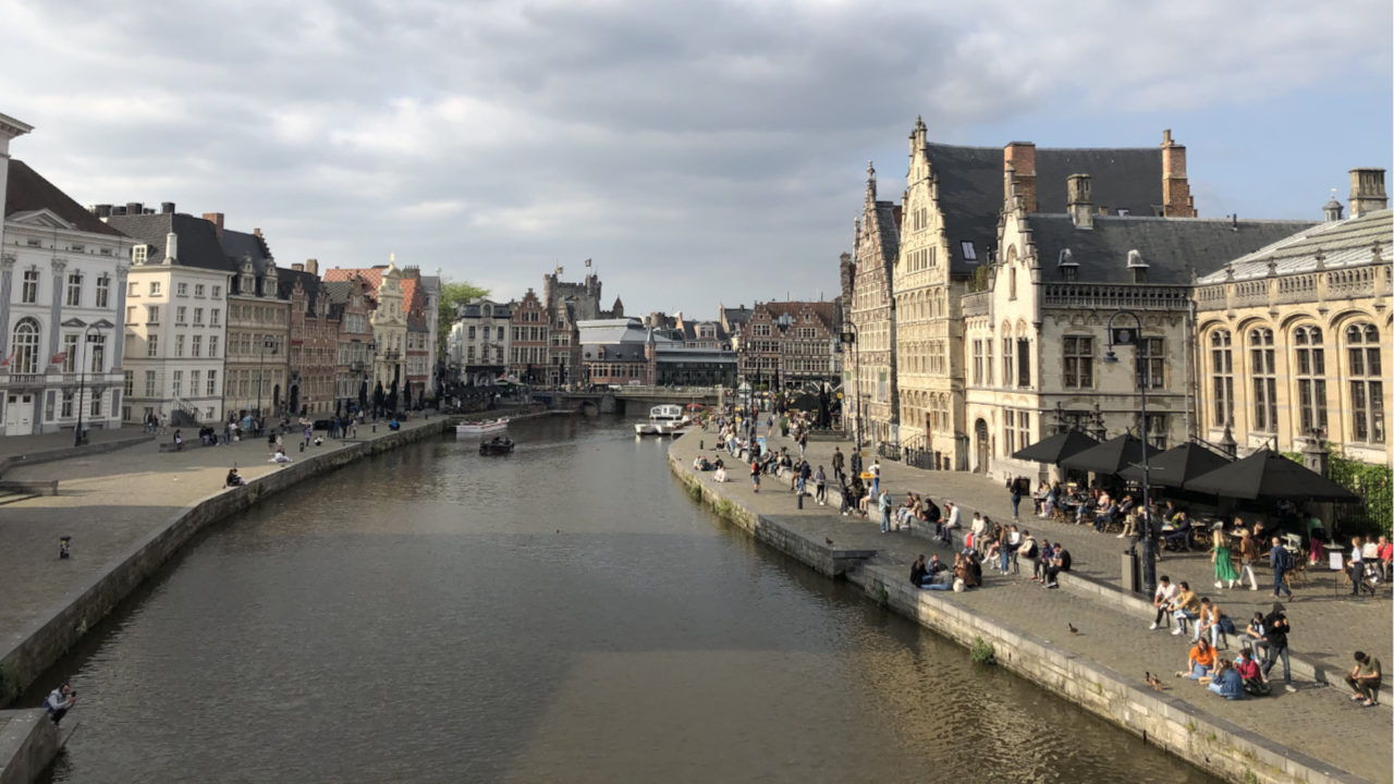
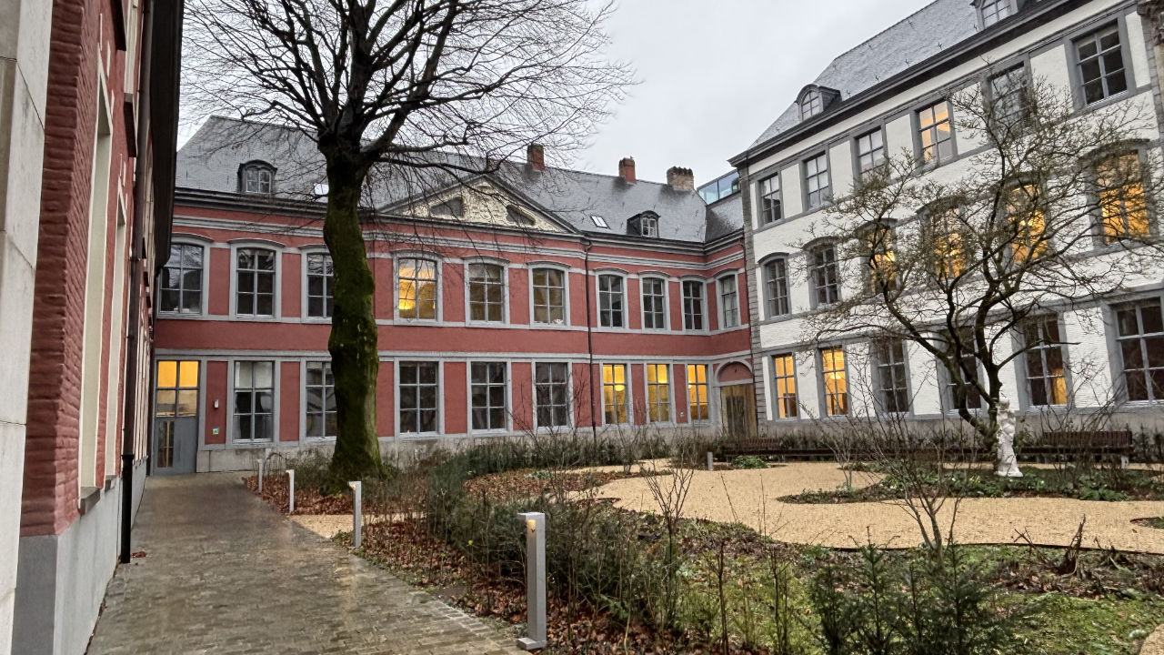
Sint-Baafshuis is located in the historic city center of Ghent, right next to the Cathedral. Here the plenary and parallel sessions will take place. Once a medieval armoury, today it is a versatile event venue for seminars and conferences. The building was completely renovated in 2024. Take a look inside the conference venue here.
Spa
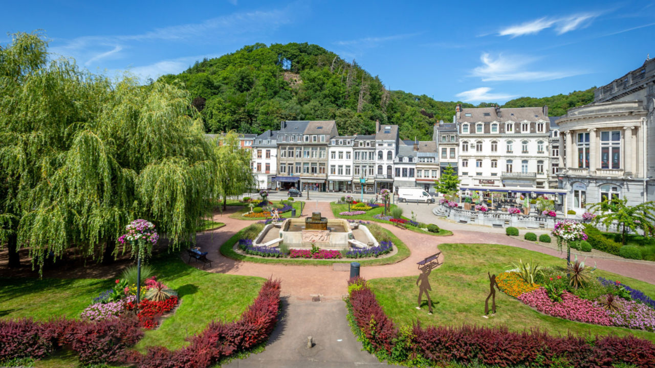
In Spa, the conference will take place at Radisson Blu Balmoral Hotel. Perched on the heights of Spa and overlooking lush, forested valleys, the hotel has a unique connection to the surrounding landscape. The architecture blends regional authenticity with modern comfort, providing a warm and inviting atmosphere for intellectual exchange and networking. The Radisson Blu Balmoral is proudly managed by Nestia Hospitality. Your accommodation and logistical experience are professionally coordinated to ensure a seamless and premium stay in the heart of the Ardennes.

Travel
Belgium is easily accessible both by train and by plane. Many European cities have good international train connections to Brussels and Liège (via Cologne).
Brussels Airport has direct connections with all capital cities and other important airports in Europe and has an easy train connection to other cities in Belgium. The airport of Brussels South Charleroi is used by the low-cost airlines. From there, participants have to take a Flibco bus to Brussels or Ghent.
Ghent has direct train connections from Brussels Airport (one hour) and from the main stations in Brussels (for international trains).
The train from Spa to Brussels Airport (2 hours) or to Liège (45 minutes) for connections with the international trains.
Accommodation
Please note that it is your own responsibility to book accommodation during your stay. We strongly recommend booking as early as possible to secure suitable options. Especially in Spa, the availability of accommodation is limited.
We recommend these hotels as they are within walking distance of the conference venue.
Ghent (Depending on your arrival, you have to book accommodation in Ghent from 06/09 to 09/09 (three nights)).
- Ibis Gent Centrum St Baafs Kathedraal: use the discount by mailing sveinhildur.torfadottir@ibis-gent.com with 'PECSRL2026' as a reference
Spa (You have to book accommodation in Spa from 09/09 to 11/09 (two nights)).
- Radisson Blu Balmoral Hotel: the conference will take place here
- Silva Hotel Spa: it's across the street, so on walking distance from the conference venue
- We will also arrange a daily shuttle from the city centre of Spa to the conference venue. So, you can also book a hotel there.
Important dates
- 5 December 2025
- Call for sessions
- 6 February 2026
- Deadline for submission of sessions
- 1 March 2026
- Call for abstracts
- 22 April 2026
- Deadlines for submission of abstract
- Beginning of May 2026
- Notification of acceptance of abstracts. Opening conference registrations
- 30 June 2026
- Closing early bird registrations
- 17 August 2026
- Closing regular registrations
Committees
The conference will be jointly organised by the Department of Geography of Ghent University (Veerle Van Eetvelde) and the Department of Geography of the University of Liège (Serge Schmitz).
Scientific committee
- Veerle Van Eetvelde, Ghent University, Belgium
- Marc Antrop, Ghent University, Belgium
- Serge Schmitz, University of Liège, Belgium
- Karl Martin Born, University of Vechta, Germany
- Hannes Palang, University of Tallinn, Estonia
- Ewa Skowronek, Maria Curie-Skłodowska University, Poland
- Tim Waterman, University College London, UK
- Arjen Conijn, University of Groningen, The Netherlands
More information needed?
- By registering the email list, you will be informed directly of the next announcements and more news: fill out the form here.
- You can contact the conference organisers via: pecsrl2026@ugent.be.
- More information will be published on the conference website (this page): https://www.geography.ugent.be/PECSRL2026
Funding
The conference is funded by the FWO, Faculty of Science of UGent, FRNS and Fondation Sporck.


Funded by:



and Fondation Sporck